Introduction
In the era of advanced drone technology and geospatial analytics, Orthomosaic maps have emerged as a transformative tool for inspecting and surveying large properties. These highly detailed, accurate maps offer unparalleled insights, enabling industries from agriculture to construction to make informed decisions efficiently. This article explores what Orthomosaic maps are and their key benefits for property assessment.
What is an Orthomosaic Map?
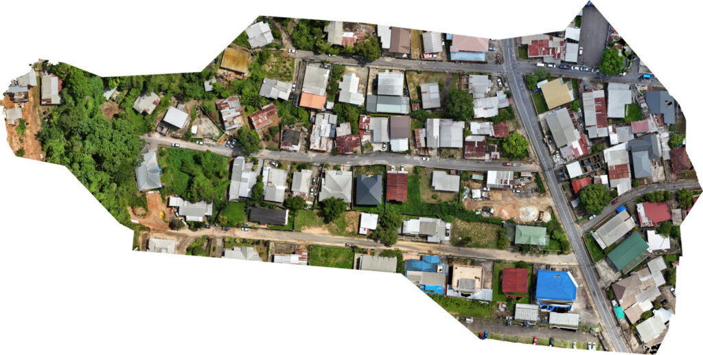
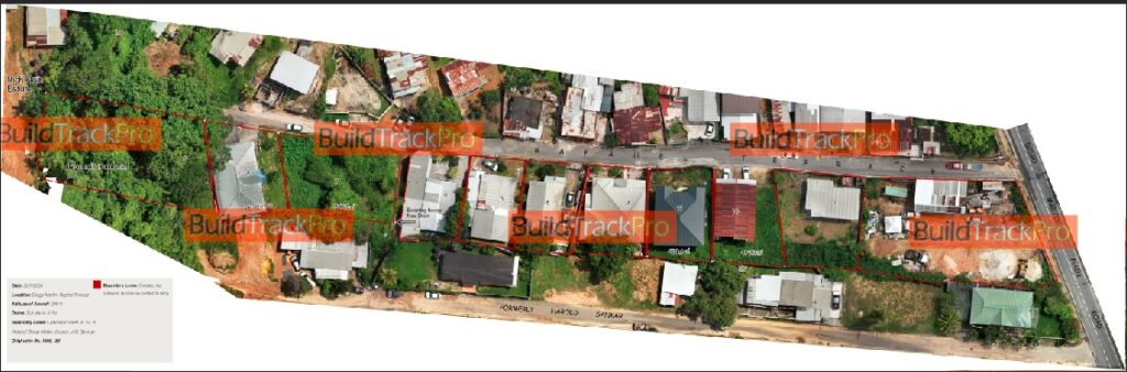
An Orthomosaic map is a composite image created by stitching together hundreds or thousands of aerial photographs captured by drones or satellites. Through a process called orthorectification, distortions caused by terrain, camera angles, and perspective are corrected, resulting in a geometrically accurate, top-down view. Each pixel is georeferenced (assigned precise geographic coordinates), enabling exact measurements and integration with GIS (Geographic Information Systems).
How Are They Created?
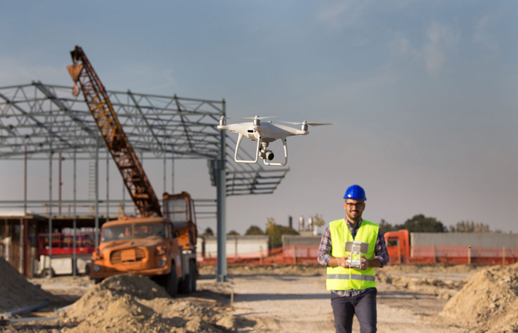
- Data Collection: Drones equipped with high-resolution cameras capture overlapping images of the property.
- Orthorectification: Software corrects distortions using elevation data, ensuring uniform scale.
- Stitching: Images are seamlessly merged into a single, cohesive map.
- Georeferencing: Spatial data is embedded, allowing integration with mapping software.
Benefits of Orthomosaic Maps for Property Inspection and Surveying
- Unmatched Detail and Resolution
Orthomosaic maps provide centimeter-level detail, revealing minute features like cracks, erosion, or infrastructure wear. This precision is invaluable for identifying issues early, reducing long-term costs. - Time and Cost Efficiency
Drones survey vast areas rapidly—hours instead of days—minimizing labor and equipment expenses. Clients save significantly compared to traditional ground-based methods. - Enhanced Accuracy
Georeferencing and orthorectification ensure measurements (distance, area, volume) are highly accurate, critical for legal surveys, construction planning, and resource management. - Comprehensive Overview
View the entire property in one image, facilitating better planning and spotting patterns (e.g., drainage issues) invisible at ground level. - Remote Accessibility
Share digital maps instantly with stakeholders worldwide, enabling collaborative decision-making without site visits. - Environmental and Temporal Monitoring
Track changes over time (e.g., crop health, erosion) by comparing historical maps. Ideal for compliance reporting or ecosystem management. - Safety Improvements
Inspect hazardous areas (e.g., unstable terrain, industrial sites) remotely, reducing risks to personnel. - Integration with Advanced Technologies
Compatible with GIS, BIM (Building Information Modeling), and AI analytics, enhancing applications like 3D modeling, resource allocation, and predictive maintenance. - Versatility Across Industries
- Agriculture: Monitor crop health, irrigation, and soil conditions.
- Construction: Track progress and manage site logistics.
- Real Estate: Showcase properties with interactive maps.
- Emergency Response: Assess disaster damage swiftly.
- Legal and Historical Documentation
Serve as reliable legal records for boundary disputes or regulatory compliance. Archival maps provide a timeline of property evolution.
Conclusion
Orthomosaic maps are a game-changer for large-scale property inspection and surveying. By combining high-resolution imagery, geometric precision, and seamless integration with modern technologies, they empower clients to optimize operations, reduce costs, and enhance safety. Whether managing a farm, overseeing construction, or responding to emergencies, adopting Orthomosaic mapping is a strategic move toward data-driven excellence. As industries continue to embrace digital transformation, these maps will remain indispensable tools for sustainable and efficient property management.
Contact us below for more information.